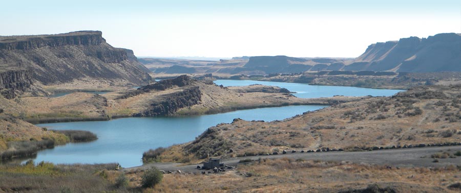
Critical Areas
The Growth Management Act (GMA) requires all cities and counties to adopt development regulations that protect critical areas. These regulations help to preserve the natural environment, maintain fish and wildlife habitat, and protect drinking water.
Critical Area Requirements under GMA
Protecting critical areas also helps reduce exposure to risks, such as landslides or flooding, and maintains the natural elements of our landscape. It can be costly, or even impossible, to replace critical area functions and values once they are lost.
Statutory requirements for Critical Areas
RCW 36.70A.030(5) defines five types of critical areas:
• Wetlands.
• Areas with a critical recharging effect on aquifers used for potable water.
• Frequently flooded areas.
• Geologically hazardous areas.
• Fish and wildlife habitat conservation areas.
All critical areas must be designated and their functions and values protected using the best available scientific information – known as best available science or BAS. Salmonids play an extremely important role in the ecosystem and are vital cultural and economic resources, therefore jurisdictions must also “give special consideration to conservation and protection measures necessary to preserve or enhance anadromous fisheries.”
Critical Areas Handbook
Commerce has completed updates to our critical areas guidance document. The 2023 Handbook addresses the following: Wetlands rating system, Voluntary Stewardship Program, agricultural activities, FEMA Biological Opinion, availability of LiDAR, monitoring and adaptive management, a salmon recovery roadmap, and other issues.
Protecting critical areas has a nexus in several federal and state laws: including the Federal Clean Water Act, Safe Drinking Water Act, Endangered Species Act, the National Environmental Policy Act, and the National Floodplain Insurance Program (administered by FEMA); and including the Washington State Environmental Policy Act (SEPA), Shoreline Management Act, Watershed Planning Act, Salmon Recovery Act, the Municipal Water Law and the GMA. Additionally, the federal and state governments have a responsibility to ensure that tribal treaty rights are upheld, which in part requires that fish habitat is protected and improved.
2021 Critical Areas and Shoreline Monitoring and Adaptive Management Online Workshops
The Washington State Departments of Commerce, Ecology and Fish and Wildlife developed an 11-week webinar series for an in-depth review of best practices, case studies, resources and tools to enhance monitoring and adaptive management efforts for your critical areas and shorelines. Links to the videos of the workshops are listed below. For more information about the series, and to view presentations and additional webinar resources, visit the project webpage.
- Workshop 1 – How to Successfully Protect Critical Areas and Shorelines: A Step-by-Step Introduction to Monitoring and Adaptive Management
- Workshop 2 – Setting the Stage: Successful Adaptive Management and Critical Areas Monitoring Program Basics
- Workshop 3 – Wetlands
- Workshop 4 – Geologically Hazardous
- Workshop 5 – Fish and Wildlife Habitat Conservation Areas
- Workshop 6 – Frequently Flooded Areas
- Workshop 7 – Critical Aquifer Recharge Areas (CARAs)
- Workshop 8 – Shoreline
- Workshop 9 – Permit Implementation Monitoring Tools
- Workshop 10 – CAO Performance Indicators
- Workshop 11 – Adaptive Management Interactive Workshop

Publications and Resources
Growth Management Services and other state agencies provide technical assistance through detailed guidebooks and other publications to assist local governments in planning.
Wetlands are fragile ecosystems that serve a number of important beneficial functions. Wetlands assist in the reduction of erosion, siltation, flooding, ground and surface water pollution, and provide wildlife, plant, and fisheries habitats. Wetlands destruction or impairment may result in increased public and private costs or property losses.
In designating wetlands for regulatory purposes, counties and cities are required to use the definition of wetlands in RCW 36.70A.030(20). Counties and cities are encouraged to make their actions consistent with the intent and goals of “protection of wetlands”, Executive Orders 89-10 and 90-04 as they exist on September 1, 1990.
Resources: Washington Department of Ecology at Ecology’s GMA and Local Wetland Regulations web page
provides several guidance publications to counties and cities regarding regulations for protecting and managing wetlands. Contact information for Ecology wetlands specialists is also available if you have a specific question.
Water is an essential life-sustaining element. Much of Washington’s drinking water comes from ground water supplies. Once ground water is contaminated it is difficult, costly, and sometimes impossible to clean up. Preventing contamination is necessary to avoid exorbitant costs, hardships, and potential physical harm to people.
The quality of ground water in an aquifer is inextricably linked to its recharge area. Where aquifers and their recharge areas have been studied, counties and cities should use this information as the basis for classifying and designating critical aquifer recharge areas. Where no specific hydrogeologic studies have been done, counties and cities may use existing soil, surficial geologic and well log information to determine where recharge areas are likely to be located.
Resources: The Department of Ecology provides best available science and guidance on its Critical Aquifer Recharge Areas web page
and a contact for technical assistance.
Floodplains and other areas subject to flooding perform important hydrologic functions and may present a risk to persons and property. Classifications of frequently flooded areas should include, at a minimum, the 100-year floodplain designations of the Federal Emergency Management Agency and the National Flood Insurance Program. Historic losses to salmon habitat have occurred as a result of development encroaching into floodplains. In addition to minimizing adverse effects to human health, safety and infrastructure, floodplains are ideal locations for salmon habitat restoration.
Resources: The Department of Ecology’s Floodplain Management web page
provides information on floodplain mapping and contacts for technical assistance.
Geologically hazardous areas include areas susceptible to erosion, sliding, earthquake, or other geological events. They pose a threat to the health and safety of citizens, fish, and wildlife, when incompatible commercial, residential, or industrial development is sited in areas of significant hazard.
Some geological hazards can be reduced or mitigated by engineering, design, or modified construction or mining practices so that risks to health and safety are acceptable. When technology cannot reduce risks to acceptable levels, building in geologically hazardous areas is best avoided. This distinction should be considered by counties and cities that do not now classify geological hazards in their critical areas ordinance. Counties and cities should also consider classifying geologically hazardous areas as either known or suspected risk, no risk, or unknown where data are not available to determine the presence or absence of a geological hazard.
Resources: The Washington State Department of Natural Resources’ Geologic Hazards and the Environment web site
provides information on earthquakes and faults, landslides, volcanoes and lahars, tsunamis, and geologic hazard maps. The Department also maintains a Geologic Information Portal
that contains interactive earth science mapping, data, and related information on several topics. The Portal provides a user guide in written and video formats.
Fish and wildlife habitat conservation is the management of land for maintaining species in suitable habitats within their natural geographic distribution so that isolated subpopulations are not created. This does not mean that all individuals of all species must be maintained at all times, but it does mean cooperative and coordinated land use planning is critically important among counties and cities in a region.
Resources: The Washington State Department of Fish and Wildlife Priority Habitats and Species (PHS) Program provides relevant information on important fish, wildlife, and habitat resources in Washington. PHS is the agency’s primary means of transferring fish and wildlife information from their resource experts to those who can protect habitat. The Priority Habitats and Species web page provides a PHS list, management recommendations, GIS maps and digital data, and PHS on the Web, a web-based interactive map.
The Governor’s Salmon Recovery Office (GSRO) was formed through the Salmon Recovery Act to coordinate statewide salmon recovery. Each of the seven regions in the state developed their own locally derived salmon recovery plans, which are a good source of information about what habitats are important to anadromous fisheries and what efforts are ongoing to protect and enhance them. The GSRO and Recreation and Conservation Office website provides links to the recovery plans, monitoring efforts, policies, and the lead entities that coordinate salmon recovery locally.
Key Topics
Growth Management
Governor’s Smart Communities Awards Program
GMA Laws and Rules
GMA Periodic Update
Growth Management Grants
Growth Management Topics
Guidebooks and Resources
Civilian-Military Compatibility
Defense Community Compatibility
Regional Planners’ Forums
Short Course on Local Planning
Submitting Materials to the State for Review
Need help?
Angela San Filippo, AICP
Ecosystem Program Manager
Email: Angela.SanFilippo@commerce.wa.gov
Phone: 564-233-9522