The Washington State Zoning Atlas (WAZA) is an interactive map and downloadable database to explore generalized statewide zoning data. It is the first statewide tool in Washington that translates local zoning designations into standardized land use categories and attributes.
Zoning in Washington
Zoning shapes the places we live, work, and play. It defines what can be built and how land can be used in every part of a community. In Washington, cities and counties have the power to write and manage their own zoning rules, within the framework of the state’s Growth Management Act.
While this local control gives communities flexibility, it also means there is no standard way to publish or organize zoning codes. This makes it difficult to compare zoning information across the state.
Why build WAZA?
For anyone wanting to look at statewide zoning trends, the lack of consistent zoning data has been a major obstacle. To address this, the Washington State Legislature funded the creation of a statewide zoning atlas in 2023. The Department of Commerce launched the project in early 2024 to provide a clearer, standardized picture of zoning across Washington.
The WAZA builds upon Commerce’s existing Puget Sound mapping project to create a product that meets the unique needs of Washington State.
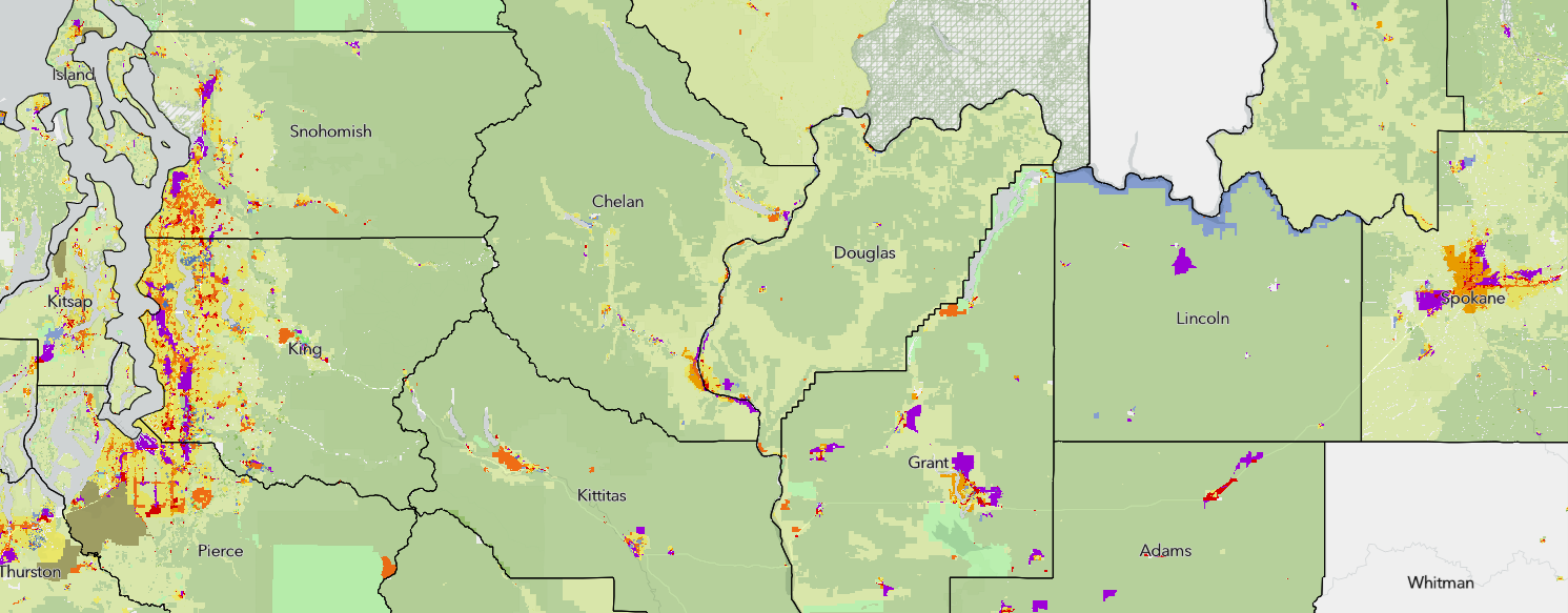
Using WAZA
The Washington State Zoning Atlas (WAZA) is the first statewide tool to translate each city’s and county’s unique zoning designations into a consistent set of land use categories and attributes. The Atlas is an interactive web map and downloadable database designed to:
- Help policymakers, planners, researchers, and local governments track zoning trends
- Provide general information about what uses and development types are allowed in different areas
- Support studies that connect zoning to other factors, such as housing supply, environmental goals, or economic trends.
The WAZA highlights many aspects of zoning, with a focus on residential and mixed-use development. It also includes valuable information about natural resource lands, green energy sites, industrial areas, and other special uses. All of the attributes included in the database are described in the user guide linked above.
Users are encouraged to explore the data and imagine ways to analyze how different aspects of zoning play out over local, regional, or statewide scales. The WAZA can be used to track trends related to housing legislation, help understand barriers to development, analyze the environmental impacts of land use patterns, and aid in site selection for difficult-to-site land uses. Users could also explore how zoning interacts with other geographic information like census data, geospatial infrastructure or habitat data.
For more ideas and example maps using the WAZA, check out the How Could I Use the Atlas? fact sheet (PDF).
Limitations
It’s important to remember that zoning remains local. Cities and counties continue to update their codes and maps regularly. The WAZA reflects data collected and standardized by Commerce and our partners from April 2024 to June 2025. Some data may be inaccurate or incomplete. Some local codes have already changed since this data was gathered. Always check your local jurisdiction’s official code and maps for the most accurate and up-to-date information.
Development team
The WAZA was developed by the Washington State Department of Commerce, with support from:
- MAKERS architecture and urban design
- BHC Consultants
- University of Washington
- Western Washington University
- Eastern Washington University
Students from Washington’s accredited planning programs took part in a first-of-its-kind cross-university course, learning about zoning and helping develop and test the WAZA’s data collection methods.